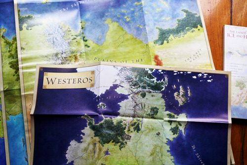
You know you have a Game of Thrones/Song of Ice and Fire problem when you run in to Barnes & Noble for the new collection of illustrated maps, The Lands of Ice and Fire, and check the non-fiction section first before you realize. Acknowledging your problem is the first step; the next is to fork over forty bucks for this beautifully drawn set of 12 maps of the known lands.

From Westeros to Asshai, cartographer Jonathan Roberts presents the best look at the world of GRRM you’ve ever seen. Several locals have yet to be mentioned in the actual series, so it’s possible that it gives us some foresight in to fun to come. Each holdfast is labeled, from the meanest to the great houses. While the complete map of the world is probably the coolest part of the whole shebang, my inner and outer geek squealed over the journey map, which tracked the travels of all the major characters to the free cities and beyond (spoilers beware). This is most helpful to someone who attempts to follow along while reading on the obscenely tiny black and whites in the front of each book.
And the maps are big. High quality posters mean that the collection ain’t exactly a traveling reference. Plus, I have an awful compulsion to mark them up and label just about everything which is the same as saying that I have a compulsion to ruin them. Fellow fans resist the urge (or make photocopies). The individual maps come in a hard cover folder of sorts, which is essential since I’ve come close to spilling something on them multiple times.
Forty bucks may be a tad pricey for some, so if you’re gonna pick it up (you should), order it off amazon for $24.
Included are
- A complete map of the known wolrd, stretching from Westeros to Asshai (a brand new map).
- A full map of Westeros, combining the North and the South.
- Map of the Dothraki Sea and the Red Waste.(a brand new map).
- The Qarth region and the lands of the far east (a brand new map).
- A “Journeys” map showing the path traveled by all the major characters.
- A map of the West featuring Westeros, the Free Cities and the Summer Isles
- A map of Central Essos
- A city map of King’s Landing
- A city map of Braavos. (a brand new map).
- Map of the lands Beyond the Wall.
- Map of the Free Cities region, west of Essos.
- Map of the Slaver’s Bay region, including Valyria and northern part of Sothoros continent.
Kaitlyn D
@deadrabbit92
Staff-writer


